-

GSJ and the Geological Survey of Austria (GBA) have signed the MOU on 31 October 2017.
[posted on November 24, 2017]
-
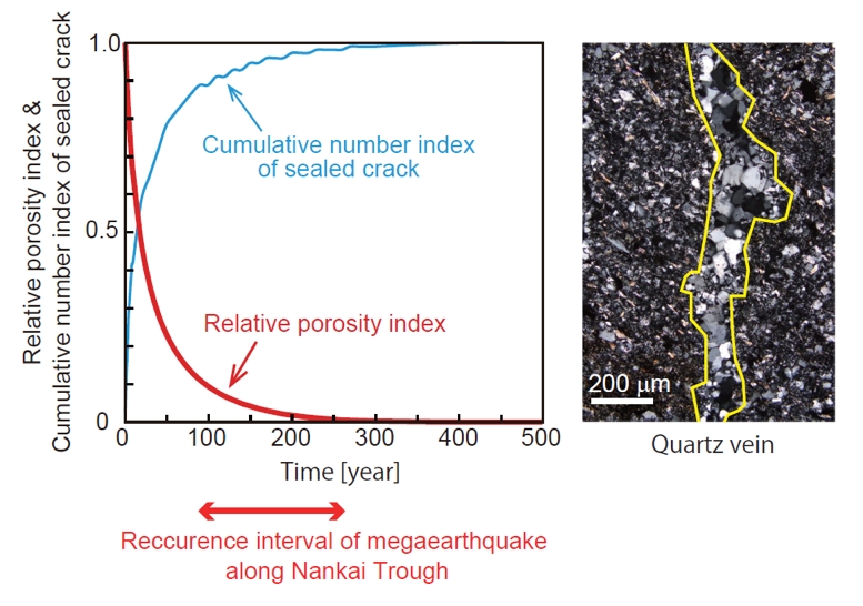
A numerical model for geochemical processes to understand the recurrence intervals of earthquakes
- Formation of extensional quartz veins potentially controls recurrence intervals of earthquakes in subduction zones -
[posted on November 24, 2017]
-
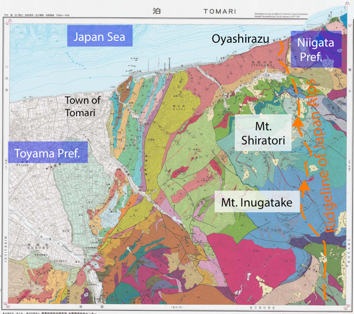
The geological history of Japanese Islands recorded in northernmost part of the Japan Alps
-“Tomari”, 1:50,000 quadrangle geological map -
[posted on October 31, 2017]
-
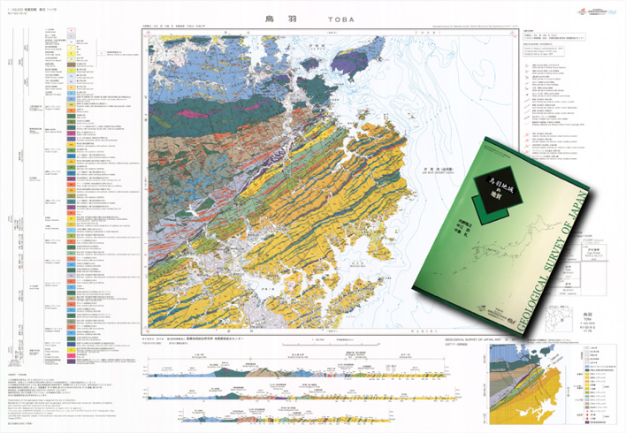
The map tells the reason why fossils of a dinosaur was found there
- “Toba”, 1:50,000 quadrangle geological map -
[posted on October 6, 2017]
-
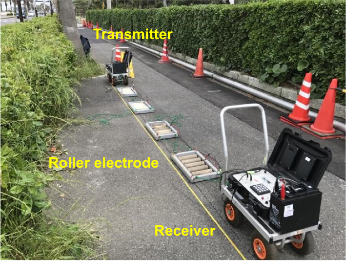
New method to directly assess the corrosion risk of water pipes
- Soil investigation using high-frequency AC resistivity measurement -
[posted on September 5, 2017]
-
Complete revision of the Seamless Geological Map of Japan at 1:200,000
- highly detailed online geological map with a hierarchical legend system has been released -
[posted on August 22, 2017]
-
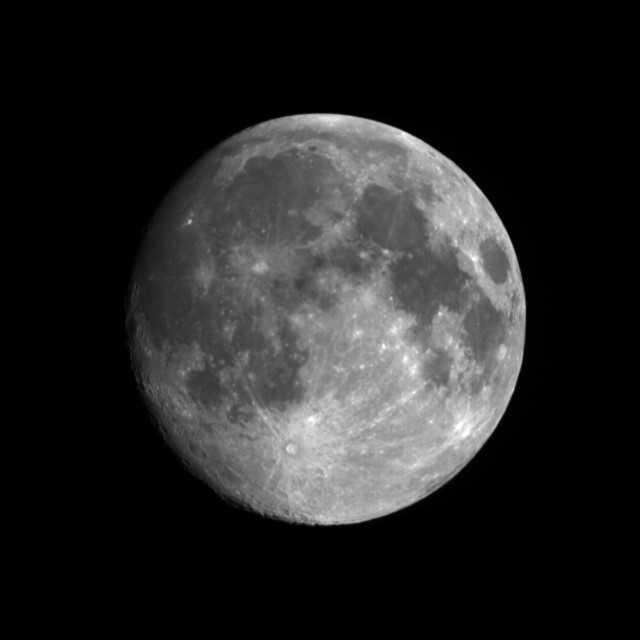
Moon image from TERRA/ASTER
-Terra ASTER performed a Moon and deep space observation on August 6th 2017 [JST] for radiometric calibration
[posted on August 17, 2017]
-
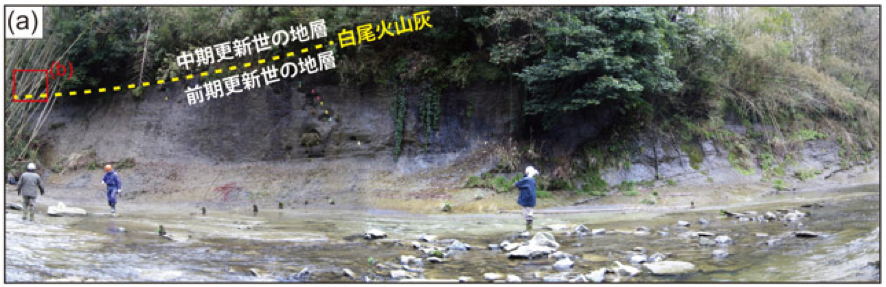
The outcrop in Chiba Prefecture has been nominated for a Global Boundary Stratotype Section and Point (GSSP)
- “Chibanian” may be listed on the geological time scale -
[posted on August 4, 2017]
-
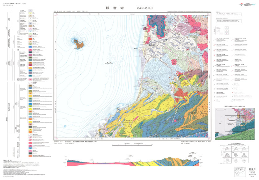
Hundred million years that have shaped today’s Kagawa Prefecture
- “Kan-onji”, 1:50,000 quadrangle geological map -
[posted on August 4, 2017]
-
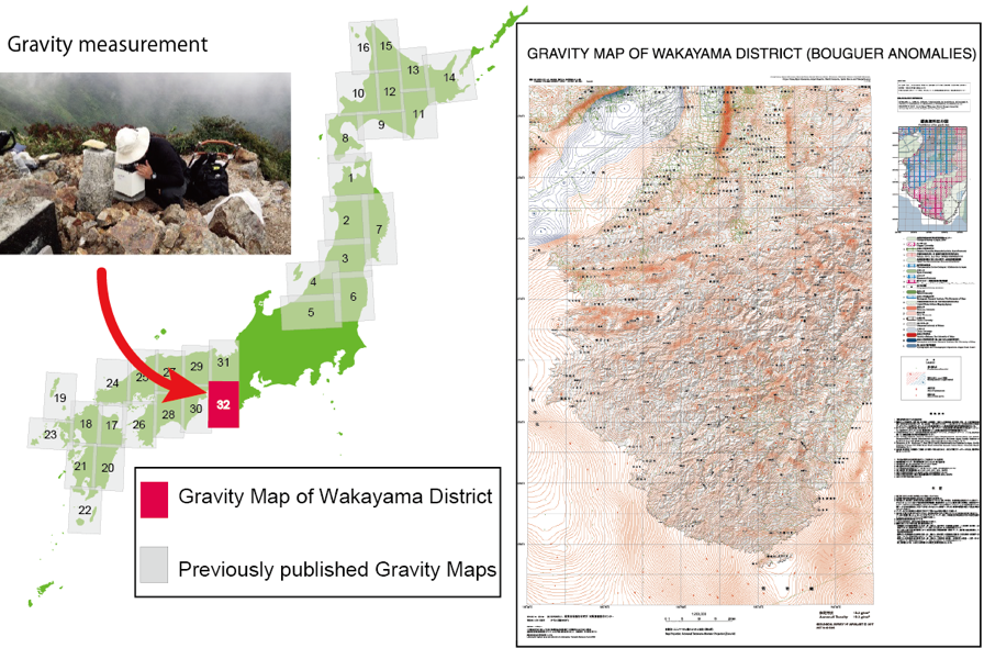
Publication of the Gravity Map of Wakayama District (Bouguer Anomalies)
- 1:200,000 Gravity Map Series, No.32 -
[posted on August 1, 2017]
-
Extreme hydrothermal conditions at an active plate-bounding fault
(Joint research with GNS Science, New Zealand etc.)
[posted on August 1, 2017]
-
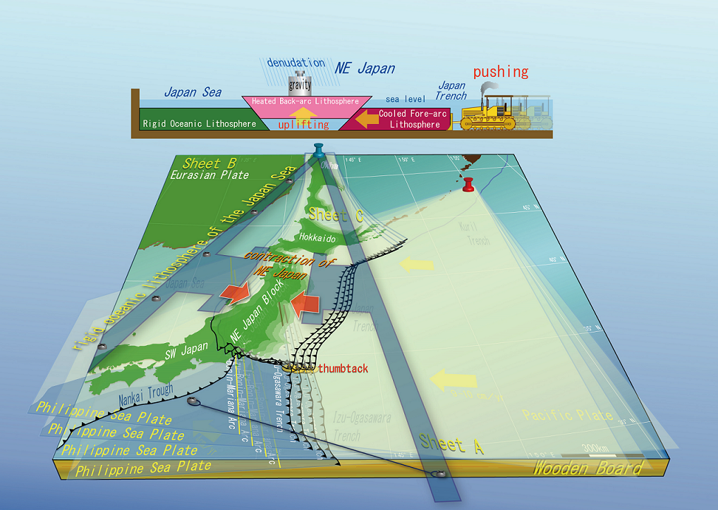
Novel geodynamic theory to elucidate tectonics of the Japanese islands
- the east-west contraction of Northeast Japan is caused by the movement of the Philippine Sea Plate -
[posted on July 31, 2017]
-

Detection of vehicles buried by a landslide using a drone with an electromagnetic (EM) sensor
- Drone EM system successfully identified the location -
[posted on July 21, 2017]
-
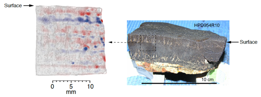
Geological application of magnetic imaging through scanning SQUID microscope
- Estimates of past climate change and age using marine ferromanganese crust -
[posted on July 11, 2017]
-
GSJ and China Geological Survey (CGS) have signed the MOU on 20 June 2017.
[posted on July 7, 2017]
-
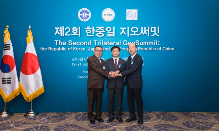
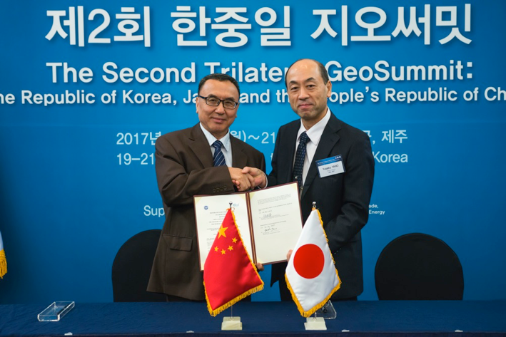
Director General Yusaku Yano and GSJ members attended the 2nd Trilateral GeoSummit on 20 June 2017
[posted on July 7, 2017]
-
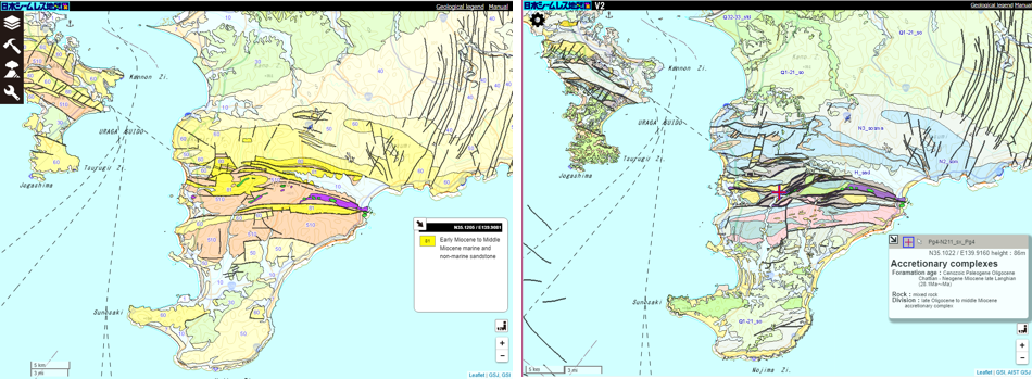
The shortest recurrence interval of Genroku-type great Kanto earthquakes revised from 2000 to 500 years (Joint research with the University of Tokyo)
[posted on May 11, 2017]
-
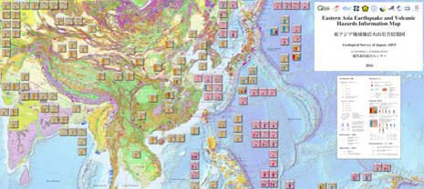
Completion of the Eastern Asia Earthquake and Volcanic Hazards Information Map - Information about past disasters displayed on a single geological map -
[posted on May 9, 2017]
-
Quick Imaging of possibly affected areas by volcanic eruption, tsunami, etc. - High-speed handling of elevation data on the Internet -
[posted on April 28, 2017]
-
GSJ and U.S. Geological Survey have extended the MOU on 14 February 2017.
[posted on March 15, 2017]
-

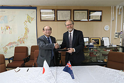
GSJ and GNS science, New Zealand have renewed the MOU on 16 February 2017.
[posted on March 15, 2017]